Log in
All resources
Create a design
928 Free Images of 1870 Maps
jacob kuyper
gemeente atlas van nederland - utrecht
gemeente atlas van nederland - south holland
gemeente atlas van nederland - drenthe
gemeente atlas van nederland - zeeland
1860s maps of south holland
charles eugène perron
maps in the library of congress
netherlands in the 1860s
1870s maps of australia
19th-century maps of the black sea
1870s maps of the caucasus
maps from the mechanical curator collection available to georeference
maps from the mechanical curator collection
gemeente atlas van nederland - zeeland
19th-century maps of zeeland
gemeente atlas van nederland - north holland
old maps of beverwijk
africa and its inhabitants, vol. ii
charles eugène perron
gemeente atlas van nederland - south holland
1860s maps of south holland
gemeente atlas van nederland - north holland
maps of bussum
19th-century maps of bohemia
1870s maps of czechia
gemeente atlas van nederland - south holland
maps of hei- en boeicop
maps from the earth and its inhabitants, vol. iii
1870s maps of belgium
maps from the earth and its inhabitants, vol. v
1870s maps of norway
maps from the earth and its inhabitants, vol. xvi
1870s maps of panama
maps from the earth and its inhabitants, vol. xvi
1870s maps of panama
maps from the earth and its inhabitants, vol. v
1870s maps of russia
village
roof
maps in the library of congress
1877 maps of the united states
gemeente atlas van nederland - north holland
maps of egmond aan zee
gemeente atlas van nederland - south holland
maps of oudewater
gemeente atlas van nederland - utrecht
old maps of amersfoort
maps from géographie illustrée de la france et de ses colonies
1868 maps
cornell: persuasive cartography: the pj mode collection
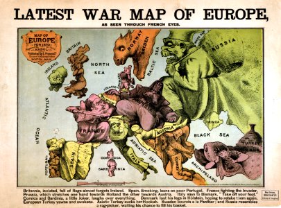
europe in the 1870s
gemeente atlas van nederland - drenthe
maps of aa en hunze
gemeente atlas van nederland - south holland
maps of noordeloos
maps in the staats- und universitätsbibliothek hamburg
1870 maps of hamburg
maps from the mechanical curator collection
australia (1873) by booth
africa and its inhabitants, vol. ii
charles eugène perron
siege of petropavlovsk
peredvizhniki
gemeente atlas van nederland - drenthe
maps of de wolden
gemeente atlas van nederland - drenthe
maps of borger-odoorn
gemeente atlas van nederland - south holland
old maps of gouda
frank leslie's illustrated newspaper, 1870
port tawfik
1870s maps of the atlantic ocean
the bottom of the sea (1870)
historical
history
nouvelle géographie universelle, vol. xii
charles eugène perron
frank leslie's illustrated newspaper, 1876
maps in the library of congress
nouvelle géographie universelle, vol. xii
charles eugène perron
gemeente atlas van nederland - limburg
19th-century maps of maastricht
topographischer atlas der schweiz
old maps of fribourg
gemeente atlas van nederland - north holland
egmond-binnen
gemeente atlas van nederland - zeeland
kreekrakdam
eran laor cartographic collection
edward weller
gemeente atlas van nederland - drenthe
maps of borger-odoorn
maps from the earth and its inhabitants, vol. xiv
1870s maps of new zealand
1866 in the netherlands
maps of almelo
gemeente atlas van nederland - zeeland
maps of polders in zeeland
gemeente atlas van nederland - zeeland
maps of polders in zeeland
gemeente atlas van nederland - south holland
maps of lange ruige weide
ismailïa. a narrative of the expedition to central africa for the suppression of the slave trade (1874)
1874 maps of africa
gemeente atlas van nederland - gelderland
maps of ophemert
gemeente atlas van nederland - drenthe
maps of aa en hunze
gemeente atlas van nederland - south holland
maps of zuidland
gemeente atlas van nederland - south holland
1860s maps of south holland
kobe foreign settlement
old maps of kobe
maps from the earth and its inhabitants, vol. ix
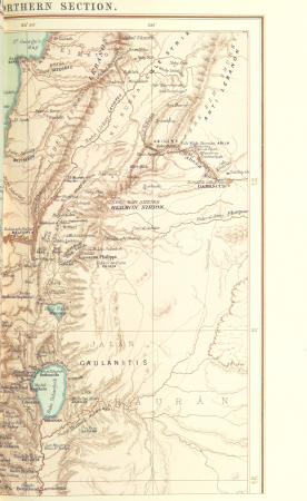
1870s maps of jerusalem
maps from the earth and its inhabitants, vol. viii
1870s maps of india
maps from the earth and its inhabitants, vol. ix
1870s maps of jerusalem
maps from the earth and its inhabitants, vol. viii
1870s maps of india
gemeente atlas van nederland - zeeland
maps of polders in zeeland
gemeente atlas van nederland - utrecht
maps of oudewater
gemeente atlas van nederland - zeeland
maps of polders in zeeland
géographie générale; physique, politique et économique (1876)
1870s maps of germany
gemeente atlas van nederland - overijssel
netherlands in the 1860s
gemeente atlas van nederland - friesland
old maps of leeuwarden
19th-century maps of the black sea
1870s maps of the caucasus
gemeente atlas van nederland - utrecht
jacob kuyper
gemeente atlas van nederland - groningen
old maps of groningen (city)
topographischer atlas der schweiz
mur (dit) d'hannibal
old maps of amersfoort
hoogland
maps from géographie illustrée de la france et de ses colonies
orientalist painting
gemeente atlas van nederland - utrecht
vreeswijk
gemeente atlas van nederland - utrecht
maps of nieuwegein
gemeente atlas van nederland - zeeland
bommenede
gemeente atlas van nederland - friesland
maps of achtkarspelen
proletarian literature
maps of gennevilliers
1870 drawings by félicien rops
symbolism,decadent movement
maps from the earth and its inhabitants, vol. vii
charles eugène perron
gemeente atlas van nederland - drenthe
old maps of coevorden
maps of aa en hunze
anloo
zeist in the 19th century
maps of zeist
19th-century maps of the western mediterranean
alfred le petit
maps from the earth and its inhabitants, vol. vii
agricultural maps of china
maps in the library of congress
1877 maps of the united states
maps from the earth and its inhabitants, vol. xiv
1870s maps of australia
maps from the earth and its inhabitants, vol. xv
1870s maps of quebec
maps from the earth and its inhabitants, vol. v
1870s maps of finland
maps from the earth and its inhabitants, vol. xiv
1870s maps of australia
maps from the earth and its inhabitants, vol. xi
1870s maps of tunisia
maps from the earth and its inhabitants, vol. vii
1870s maps of china
maps from the earth and its inhabitants, vol. x
1870s maps of egypt
maps from the earth and its inhabitants, vol. xvi
1870s maps of mexico
maps from the earth and its inhabitants, vol. xi
1870s maps of algeria
maps from the earth and its inhabitants, vol. xv
1870s maps of quebec
department of american paintings and sculpture, metropolitan museum of art
drawings by daniel huntington
maps of landgraaf
rimburg
gemeente atlas van nederland - utrecht
maps of bunnik
maps in the library of congress
1877 maps of the united states
gemeente atlas van nederland - south holland
maps of heenvliet
gemeente atlas van nederland - utrecht
maps of ijsselstein
gemeente atlas van nederland - utrecht
maps of abcoude
maps of borger-odoorn
valthe
401 - 500 of 928
Next page
/ 10